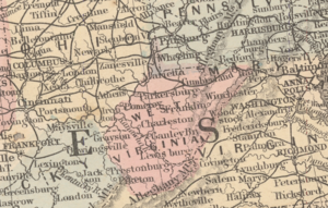
The United States and Canada have a long shared history and strong cultural and political ties. They existed together as part of British America until the independence of the Thirteen Colonies in 1783. While Canada started the journey to independence in 1867, it wasn’t until 1982 that Canada fully vested itself of the British Parliament. This Map of the month, Map of the United States and Territories together with Canada & C., shows the state of these two colonies 77 years after American independence.
While the information on the map states it was “Entered according to Act of Congress in 1860”, the map contains several pieces of information that contradict this year. Instead, the data on the map point towards a publication year of 1863 or early 1864. The first such piece of evidence is the existence of the Arizona Territory, which was a part of the larger New Mexico Territory until being officially split off into its own territory in 1863.

The map also shows a reduced Dakota Territory (Dacotah). This also places the map after March 3, 1863 as the western half of the territory was ceded to the newly created Idaho territory. Further narrowing the publication date of this map is the lack of the Montana and Washington Territories, as those were split off from the Idaho Territory on May 26, 1864.
Another feature used to date the map is its depiction of West Virginia. This indicates that the map was made after West Virginia’s admission into the union, placing the creation of the map between June 20th, 1863 and May 26th, 1864.

With all those details that paint a clear picture of publication in mid-1863 to mid-1864, why does the map indicate a publication in 1860? During research, another version of this map with data that is true to 1860 is located within David Rumsey’s Map Collection. With this information, we can say with near certainty that our map here at the ASU Library is simply an updated version of the original 1860 publication, which so commonly the case with 19th atlas maps, and, indeed, with most of modern cartography.
We hope you enjoyed our April 2025 Map of the Month!
- Title: Map of the United States and Territories, together with Canada &c.
- Date: 1863-1864
- Author: Samuel Augustus Mitchell, Jr.
- Publisher: Samuel Augustus Mitchell, Jr.
As with all of our Map of the Month features, if you’d like to learn more about this map or schedule a visit to explore our maps in person, please submit a Map and Geo Service Request. We’ll be sure to get back to you within two business days, but typically sooner.
-Grace Behan, Map and GIS Assistant


